Local Logic is a location intelligence provider that quantifies location at scale to drive better-informed real estate decisions. For CRMLS users, that means providing you with valuable local data insights that are important to your clients: Demographics, Location Scores, Local Neighborhood Profiles, Points of Interest, and School Data.
Read more to learn how to access Local Logic insights from within each CRMLS system.
Jump to:
Flexmls Desktop
From a listing, select the Detail tab, then the more button, and select Demographics or Points of Interest.
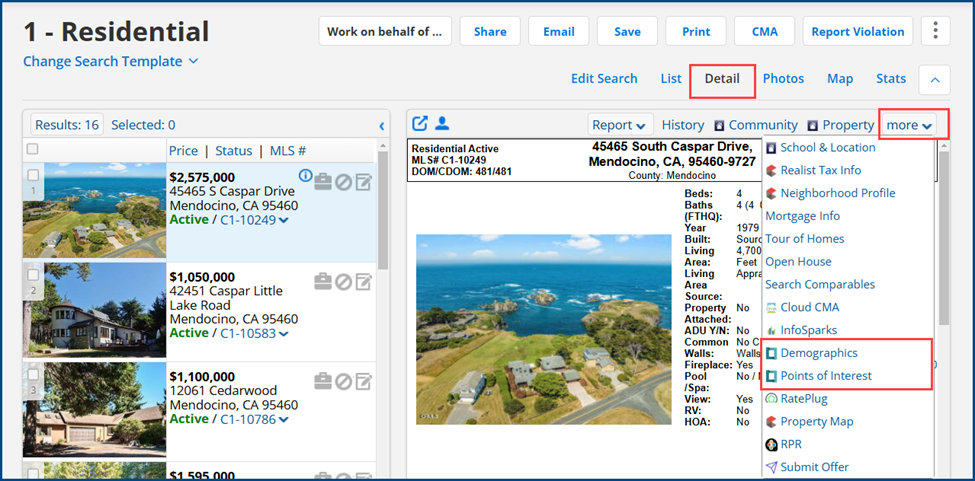
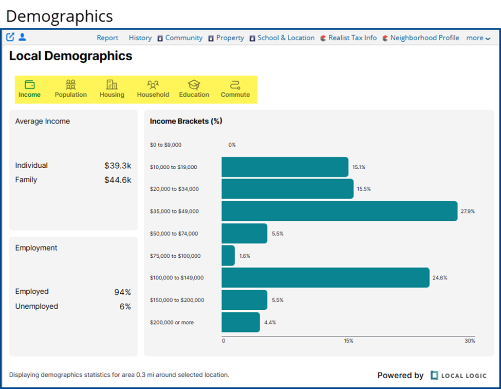
Demographics
Graphs and statistics in several demographic categories.
- Income: Average household and individual income, employment status, etc.
- Population: Average by age
- Housing: Owners vs renters, housing type, etc.
- Household: Average age of households, marital status
- Education: Levels of education reached
- Commute: Car-friendly, pedestrian-friendly, etc.
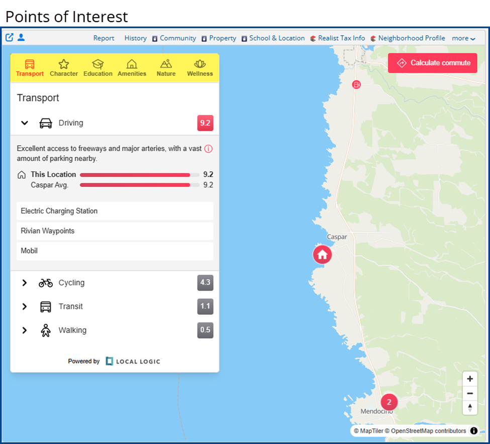
Points of Interest
These points of interest contain thorough insights surrounding a property or community that including amenities, education, transportation, and more.
- Transport: Local public transportation, gas stations, electric charging stations, and more
- Character: Noise levels, quiet areas, nightlife, and vibrancy
- Education: A map of schools filterable by type and education level to find properties within certain school zones
- Amenities: Nearby restaurants, coffee shops, grocery stores, shopping, and more
- Nature: Parks and greenery
- Wellness: Medical facilities, fitness centers, and more
Flexmls Mobile
From the FlexMLS Pro mobile app, select a listing and select either Points of Interest or Demographics.
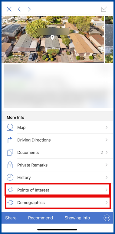
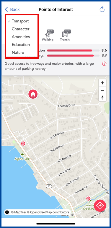
Points of Interest
These points of interest contain thorough insights surrounding a property or community that including amenities, education, transportation, and more. Choose your preferred option using the drop-down menu.
- Transport: Local public transportation, gas stations, electric charging stations, and more
- Character: Noise levels, quiet areas, nightlife, and vibrancy
- Amenities: Nearby restaurants, coffee shops, grocery stores, shopping, and more
- Education: A map of schools filterable by type and education level to find properties within certain school zones
- Nature: Parks and greenery
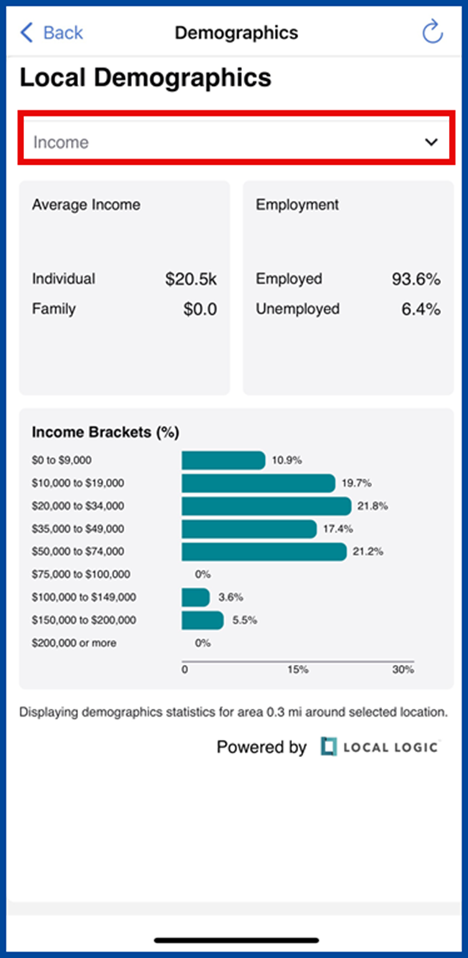
Demographics
Graphs and statistics in several demographic categories. Select your desired information using the drop-down menu.
- Income: Average household and individual income, employment status, etc.
- Population: Average by age
- Housing: Owners vs renters, housing type, etc.
- Household: Average age of households, marital status
- Education: Levels of education reached
- Commute: Car-friendly, pedestrian-friendly, etc.
Matrix
Local Logic can be accessed from either the Three-Panel Search or the Classic Search interfaces.
When using the Three-Panel Search interface, select the View Details button from either the property’s summary or from the Full Display.
When using the Classic Search interface, go to the 360 Property View and navigate to either the Neighborhood or Demographics tabs.
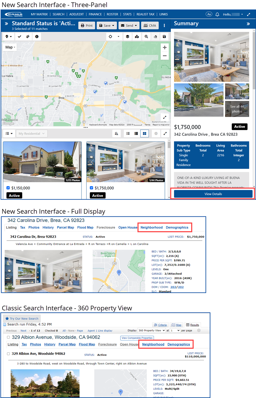
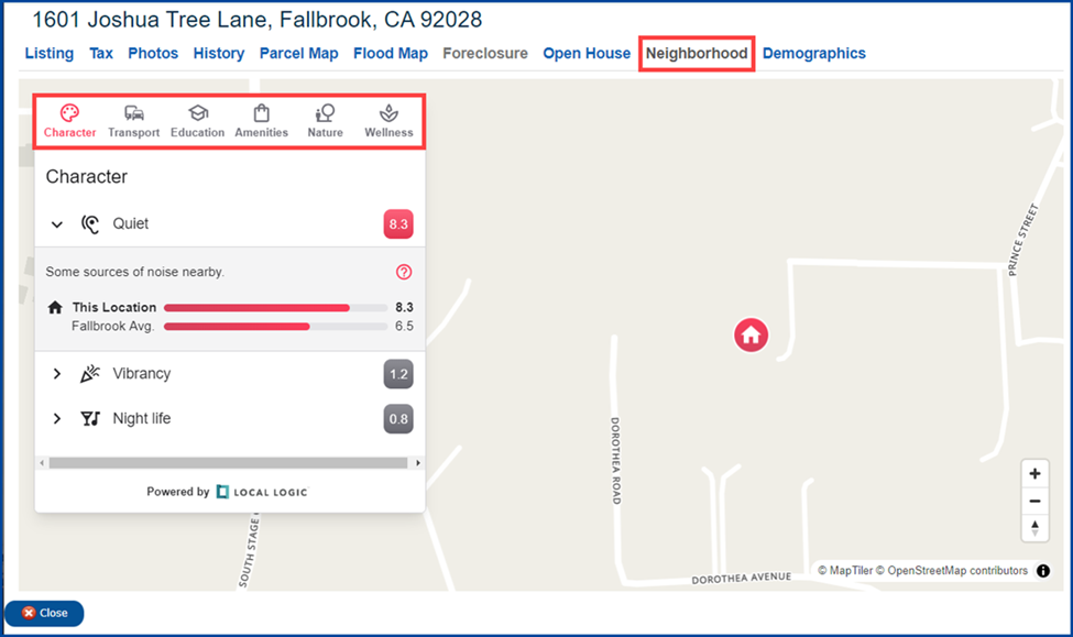
Neighborhood
This tab contains thorough insights surrounding a property or community including amenities, education, transportation, and more.
- Character: Noise levels, quiet areas, night life, and vibrancy
- Transport: Public transportation in the area, gas stations, electric charging stations, and more
- Education: A map of schools, filterable by type and education level, to find properties within certain school zones
- Amenities: Nearby restaurants, coffee shops, grocery stores, shopping, and more
- Nature: Parks and greenery
- Wellness: Medical facilities, fitness centers, and more
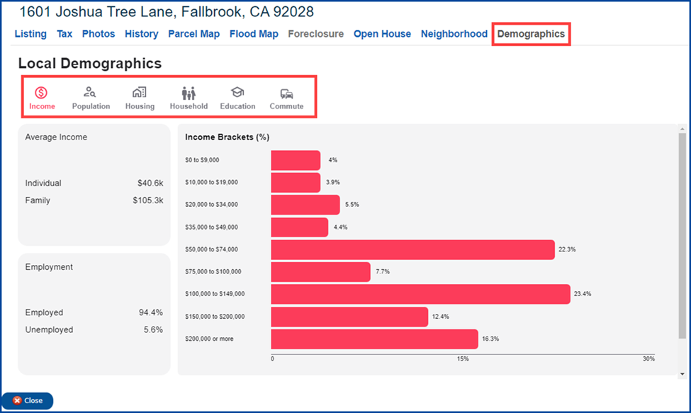
Demographics
This tab displays graphs and statistics regarding population data.
- Income: Average household and individual income, employment status, etc.
- Population: Average by age
- Housing: Owners vs. renters, housing type, etc.
- Household: Average age of households, marital status
- Education: Levels of education reached
- Commute: Car-friendly, pedestrian-friendly, etc.
Paragon Collaboration Center
Community
In the Collaboration Center, select your desired property then select the Community Reports.
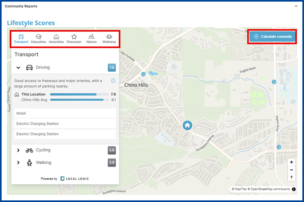
Lifestyle Scores
Includes points of interest (POI) near the property. Select a POI from the list to highlight it on the map and access the POI’s link. You can also calculate the commute time to POIs by car or on foot.
- Transport: Public transportation in the area, gas stations, electric charging stations, and more
- Education: A map of schools filterable by type and education level to find properties within specific school zones
- Amenities: Nearby restaurants, coffee shops, grocery stores, shopping, and more
- Character: Noise levels and quiet areas, night life, local vibrancy
- Nature: Parks and greenery
- Wellness: Medical facilities, fitness centers, and more
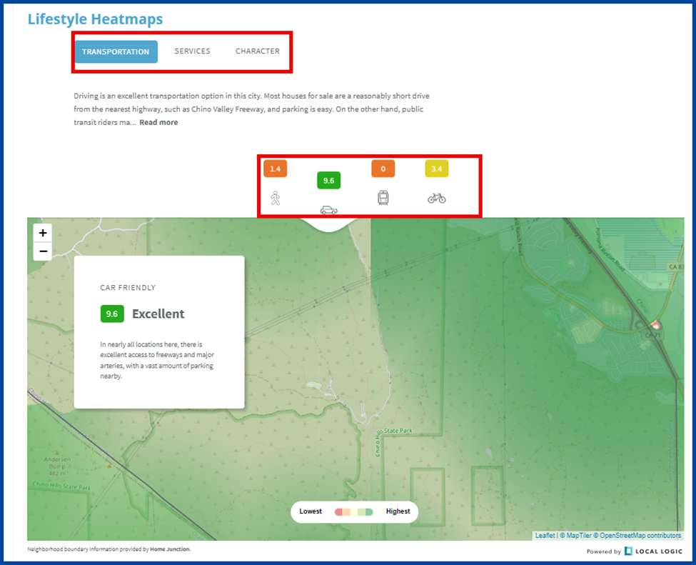
Lifestyle Heatmaps
Property neighborhood information is divided into three sections with a brief description of each. The heatmap defines boundaries for each area and rates them from “Excellent” to “Poor” in the following categories:
- Transportation: Walkability, availability of public transportation, accessibility by car
- Services: Access to grocery stores, shopping, restaurants, coffee shops, and more
- Character: Noise levels and quiet areas, night life, local vibrancy